Bike Down Mt Wellington

View from the Top

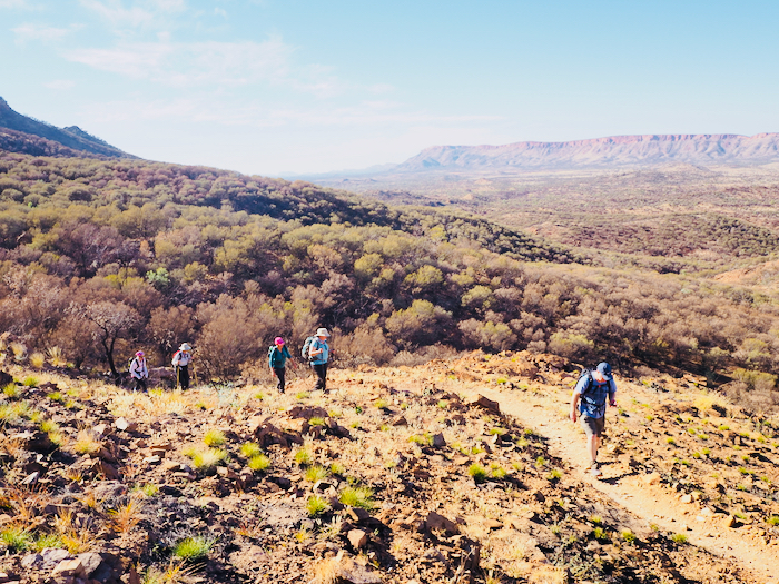
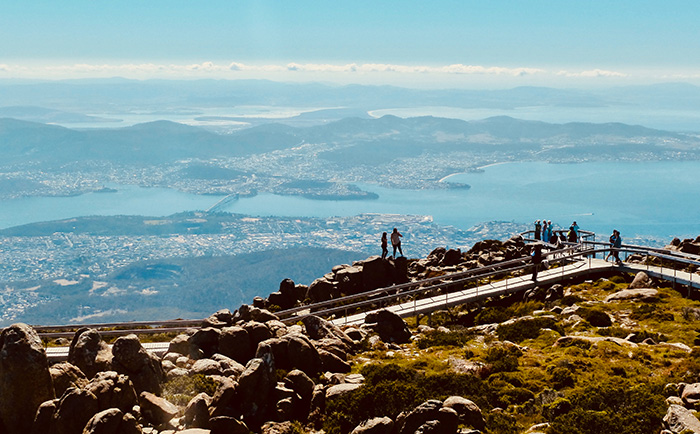
While it’s certainly not the only bicycle experience to tick off in Tasmania, or even on our bucket list, this ride does have a crucial element we can all appreciate: down. Bike rides are great but, unless you’re into pain and muscular glory, they’re even more fun when all you have to do is hang on, apply the brakes and let gravity do the rest. Add spectacular views over one of Australia’s most beautiful cities – or the chance to rip through some local trails – and this bucket list experience all but pedals itself. The peak called kunanyi/Mount Wellington (a dual name that respects the mountain’s Indigenous heritage) towers 1271 metres over Hobart. It features the Jurassic dolerite ‘organ pipe’ cliffs that I’ve seen on mountains in Argentina, South Africa and Antarctica, geological reminders of the days when all three were linked as the Gondwana supercontinent. More importantly for local residents, the imposing mountain creates a rain shadow, allowing Hobart to be the second driest capital in the nation, even though it is located in a rather wet state. Often capped with snow year- round, the summit lookout has significantly lower temperatures than downtown Hobart. You can also expect blustery winds, a sensational view and a dozen people wearing fluorescent vests standing next to mountain bikes. Under Down Under Tours run two to three descents of the mountain every day during summer, providing transfers, bikes, guides and a support vehicle. On the drive up, passing the remains of hard- wood trees destroyed in a huge mountain fire in 1967, our guide points out hazards to watch for.

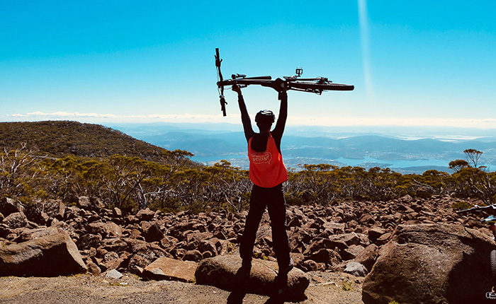
‘We’ll be going down 21 kilometres. Don’t worry, I’ve rarely seen anyone break out in a sweat,’ he says, reassuringly.
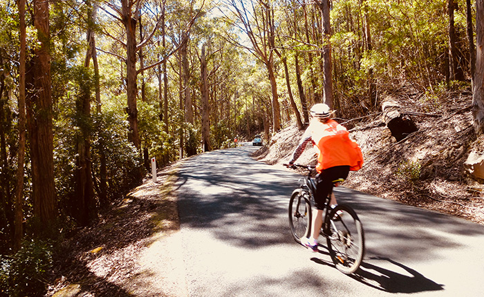
Certainly, the weather is cooperating a lot better than my first descent a dozen years ago. I still remember the wind chill blowing through my bones, and the disappointing view of mist from the lookout point. Today I see Greater Hobart and its surrounds in all its glory – the city, hills, islands, ocean and Derwent River. I also see people arriving at the summit having pedalled up by bicycle, which must be spectacular fitness training and/or a horrendous form of physical torture. We hop on our bikes and begin the first descent to a spot where we can regroup, take some photos and adjust our seats for comfort. Two kilometres pass very quickly when you’re rocketing down a steep hill surrounded by alpine forest. We’re advised to keep left as we’re sharing the road with cars, and without lines in the road vehicles tend to gravitate towards the centre. We’re merely cruising down, taking corners as fast as our nerves can handle, with our support vehicle bringing up the rear. At
our next meeting spot, our guide Lainie points out an optical illusion. In the distance below is the gentle arc of the Tasman Bridge linking Hobart to the eastern suburbs. ‘If you stand the Tasman Bridge on its end, it would be taller than Mount Wellington,’ she muses, which seems illogical from way up here, but since the bridge is 1.4 kilometres long, it makes perfect sense.

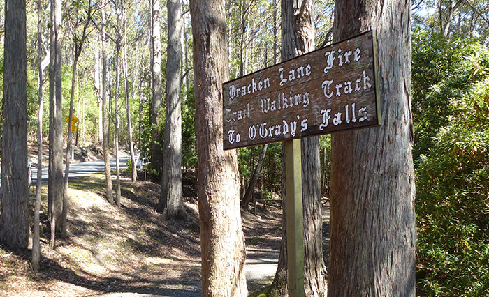
As we continue onwards, the flora changes to reflect the altitude, although I’m too busy looking ahead and smiling with the exhilaration of speed. Bikers can opt for an off-road section next, which everyone in my group agrees would be a fine idea. Although there will be some peddling and tricky navigation over loose gravel, it’s an opportunity to experience the unspoiled natural environment off the paved road. Biking on forest trails, we reconnect with the road and continue into the suburbs that have been cut into the foothills. We stop at the Cascade Brewery to admire the old convict-cut stones, and pedal past the historic Female Factory (where thousands of convict women and children were imprisoned) before joining city traffic. Snaking through various neighbourhoods, we conclude
the ride at our departure point on Elizabeth Street. All in, it’s a two-and-a-half-hour round trip, although without the stops to regroup and chat, you could shave much of that time off. As a tour, it’s a fine way to orientate yourself around Hobart, and easily one of the world’s best commercial biking descents. Our short stint in the forest leaves me hungry for more. With its hilly surrounds, fresh air and great views, Tasmania offers some of the best mountain biking in the country.

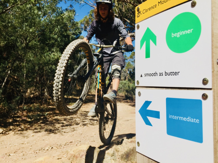
That same afternoon, Harry Nichols – local hero, up-and- coming Enduro World Series competitor and Discovery Parks brand ambassador – agrees to take me into the Meehan Range bike park in Clarence. It’s a popular play- ground of marked trails, tracks and jumps, although this time I have to pedal up to enjoy the down. Harry blitzes on runs named Corkscrew, Cliff Top and Smooth as Butter, and I do an awful job trying to keep up. I do, however, execute a couple of awkward wipeouts.
‘Please don’t do as I do. Just go where I go,’ I tell Harry. Harry tells me about the Maydena Bike Park, the country’s biggest gravity-based bike path, which opened up about ninety minutes outside the city. Tasmania has a welcoming community of mountain bikers, volunteers, bike shops and trail keepers; it’s the kind of destination that belongs on any enthusiastic mountain biker’s bucket list. As for the rest of us, all we have to do is sit in the saddle and start at the top of a mountain.

Click here for more info about the Mount Wellington Descent from The Great Australian Bucket List. 

Life on the Larapinta Trail

Australia’s most iconic outback trek was the last tick on my Australian Bucket List, and one of the first things I tell people to add to theirs.  The landscape is truly extraordinary, and with World Expeditions taking care of everything including the logistics, meals and accommodation, you don’t have to sweat it either.  As with all the other experiences in my book, just a few photos made it to print, but I took so many more.  I thought I’d share some of them this month as the outback sun cools down and the Larapinta Trail season kicks into high gear.

Smashin’ the Pinta!

Firstly, a shout out to my group.  Yes, they happened to be predominately women, which is awesome, and from New South Wales, which we won’t hold against them ; )  Point is, doing the Larapinta in Comfort, as this World Expeditions package is called, will appeal to all shapes and sizes, and anyone who enjoys day hikes.  Don’t be put off by the multi-day trekking aspect of it, because we’re not in the Himalayas, there’s no altitude, and the pace is doable for anyone with a modicum of fitness.  Two exceptionally able guides are with you all times, and if you want to sit it out, that’s entirely up to you.  While I wouldn’t recommend this one for young kids, trekkers well into their 70’s have been “smashing the ‘Pinta” successfully for years.

Away we Go

I took this picture just minutes into the start of our six day adventure.  Everyone was fresh and eager and getting to know each other on the trail.  It’s also a good opportunity to figure out how your boots, poles and gear is going to hold up in the days ahead.

Into the West MacDonnell Ranges

It doesn’t take long before you crest the plateau of the West MacDonnell Ranges and instantly grasp what all the fuss is about.  The gradient is relatively flat, and the views incredible.  Before each leg, your guides explain what’s coming up next, and prepare you mentally for the hike ahead.  There’s plenty of time to stop and take photographs.  Incidentally, I carried a mirrorless Olympus to keep things light. Some hikers brought their DSLRs, others were more content to just use their phones.  One of the best shots in my book was taken by a fellow hiker using her Google Pixel phone!

Check out the video! 

Into Camp
Camping in Style

World Expeditions have their own impressively sustainable camps set up.  It’s like camping without the hassle.  Delicious meals are cooked for you, there are solar hot showers, cots and sleeping bags in large canvas tents, and couches to stretch out your feet and enjoy a glass of wine.   Speaking of which:  hikers can pick up their own booze in Alice Springs before the journey, which is driven ahead (along with your bags) to each campsite along the trail.  Just to clarify: You’re not doing the full Larapinta trail, but a curated six-day hike that encompasses the very best bits!  And compared to sleeping in a small tent, carrying all your food and cooking it on scrappy camp utensils, this is very much what comfort looks like.

Simpsons Gap
Serpentine Gorge

Each day’s hike has a destination highlight, bursting with natural beauty and cultural significance.   Sacred watering holes and slices in the red escarpment, both of which attract wildlife and wonder.  They’re also great spots for snack breaks!   Most of these can be accessed by bus from Alice Springs and form part of the tourist attractions in the region.  You’ve come in on foot though, so you’ve earned it!

One Step at a Time
On the Trail

Here’s some hiking shots to give you an idea of the landscape and trail quality.   Low shrubs and trees, blue skies, and comfortable trekking.  Most of us used a pole or two, some didn’t feel the need for them. We carried only daypacks with snacks and water, bug spray and sunscreen.   One guide in the front (with the faster walkers) and one in the back (with the straddlers, like myself).

Lunch Break

Lunch consists of sandwiches and wraps, fruits and nuts, carried in and out by our wonderful and superhuman guides.  Always a welcome opportunity to top up the energy reserves, stop in your tracks to look for wildlife, and appreciate the surprisingly dense vegetation.

Mount Sonder Sunrise
Coming down Mount Sondor

The climax is undoubtedly Day 5, which involves a steep, 8-kilometre long climb up Mount Sondor to catch one of the most epic sunrises in Australia. We woke up at 3am. It’s quite an experience hiking at night under the galaxy of stars that paint the skies in this part of the world.  It’s hypnotic watching your headlamp light the way forward. Mount Sondor is officially the end of the Larapinta Trail, and also its highest point.  We watched the sunrise, and returned along the same path to witness the spectacular scenery we’d missed in the dark on the way up.  It’s a challenging day, but after 4 days trekking, your muscles are warmed up for it, your boots are broken in, and the sheer adventure gets you over the tough part. After that, it’s downhill all the way.

Pounding the Pound
Ormiston Pound

The final day is an easy 6-kilometre walk into Ormiston Pound, which isn’t technically part of the Larapinta Trail, but you can quickly see why its on the itinerary.  Hiking between the spiky spiniflex, we were asked by our guides to enter the gorge in silence, reflecting on the beauty around us, and also the adventure we’d had this past week.  It’s a very special place, and impossible not to enjoy a very special moment.  From here, the bus picked us up, and returned us to our hotels in Alice Springs.  The group met up that night for dinner and drinks, and a well-earned toast to one of the greatest adventures on The Great Australian Bucket List.

Special thanks to the ‘Smashin’ the Pinta’ crew who made my experience so memorable.

If you’re inspired to tick off the Larapinta Trail, click here for more information from World Expeditions.